Hungerscapes
“ … a landscape that remembered everything that had happened in and to it … “.
Patrick Heaney speaking of his native Ireland
In general then, photographs take on meaning only when more broadly contextualized. The earliest and and perhaps most ubiquitous example of this understanding was and perhaps still is, the family album; a form of pictorial storytelling in which the meaning of each image depends on both its relationship to the viewer’s experience and its place within an overall narrative. In many ways the news photograph or on a larger scale, the photo-story are little more than extensions of this idea, but with context dependent on captions or associated text rather than on personal familiarity with the subject or experience. When applied to a photograph of even the most seemingly banal of subjects, the standard journalist’s creed of who, what, where, why and when has the power to open a flood of potential responses, encouraging in viewers any of a full range of emotional possibilities, speculations and memories. This form of contextualization is also a reminder that all photographs are inherently history, both in themselves and in what they portray. In my view this is particularly relevant to photographs of land and underlies my rationale for making photographs of it. This may seem odd to some, but consider the following from the American historian Thomas Laqueur , “ … precisely because [landscape] is so resolutely atemporal, so resistant to closure, so open to all manner of reverie, it stands in … sharp contrast to history.”. … And yet, I believe it is in this that land and photography converge, for even though their relationship to history advances from opposite directions, the land and the photograph meet at the point where by specifying a time from within the land’s otherwise atemporality, the photograph effectively makes “place” of undifferentiated space. Laqueur goes on to say, “ … Space ( that is, the land ) is the ground for remembering against time. … Memory ( the photograph ) is a means of making the loss survivable but it is also therefore a means of allowing the past to have closure …”. ( parentheses mine ).
Which brings me to this body of work. In 1989, while working on another ( ongoing ) project, “Continental Edge”, I photographed a number of dry-stone walls emerging from the ocean off the coast of County Clare in Ireland. These walls advanced across the beach and stretched on for miles, finally disappearing into the mist above the distant hills. This was my introduction to the Great Irish Famine of the 1840’s or as more accurately described in Irish, “An Gorta Mór”, The Great Hunger. The walls I learned were just one of many projects carried out as part of a public works scheme contrived to help a starving population earn money to buy food. In 2014, I again found myself in Ireland, living for a time near the West Cork town of Skibbereen which, it turned out had been the epicentre of one of the areas most severely effected by An Gorta Mór. The Heritage Centre in Skibbereen maintains an extensive display related to the Hunger and in the nearby cemetery at Abbeystrewery there is a small, grassy plot beneath which it is said, piled one atop the other, lie the uncoffined remains of some 7000 people, men, women and children who died from either hunger or diseases brought on by malnutrition, poverty and neglect. It is impossible to know how many others died lacking even this small gesture of respect and whose remains now lie unknown and unmourned beneath the fields and ditches of the surrounding landscape. The present population of Skibbereen is less than 3000.
I have since returned a number of times to photograph sites having some relationship to the Hunger years, As is my habit, almost all these images cover 360º. As prints, they are quite large, in some case extending more than 8 metres. The appended texts are drawn from a variety of contemporaneous sources. The map coordinates give the site of camera placement; the listed date and time are accurate descriptions of when the exposures were made. Geographic context may be accessed by clicking on the map coordinates.
Tuesday, November 29, 2022. 10:59 – 11:10 am. GMT
Tuesday, November 29, 2022. 10:30 – 10:47 am. GMT
Monday, November 28, 2022. 11:39 am. – 12:11 pm. GMT
Saturday, November 26, 2022. 12:56 – 1:06 pm. GMT
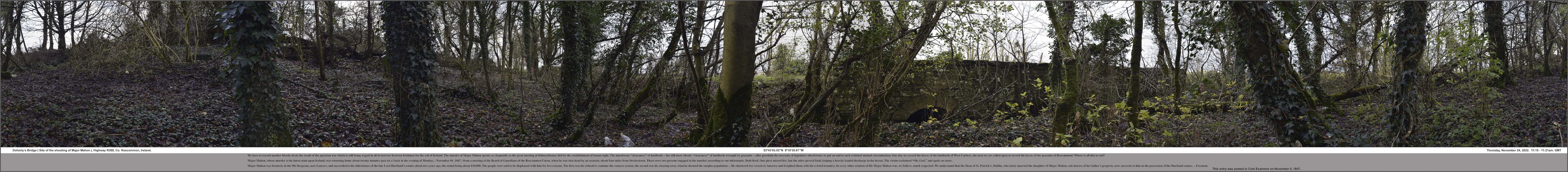
Thursday, November 24, 2022. 11:15 – 11:21am. GMT
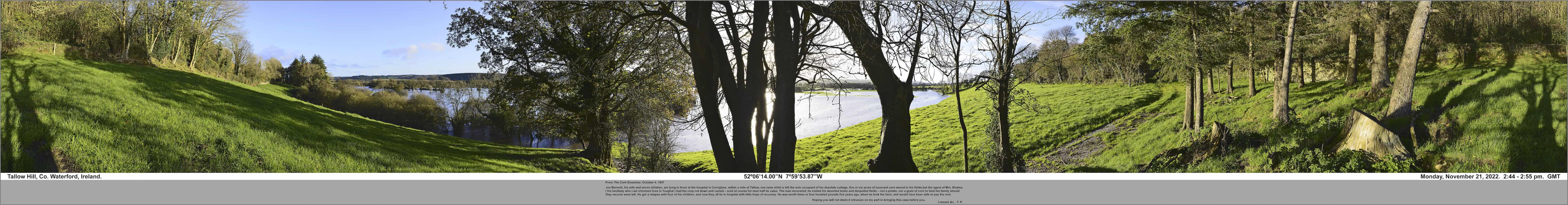
Monday, November 21, 2022. 2:44 – 2:55 pm. GMT
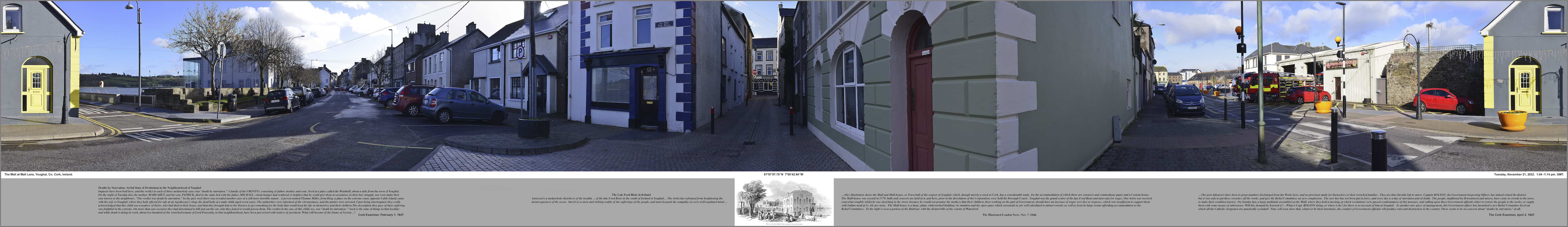
Monday, November 21, 2022. 1:04 – 1:14 pm. GMT
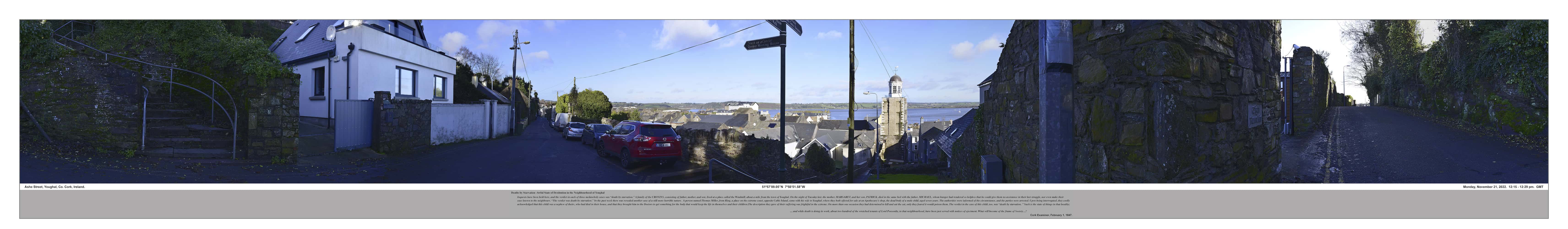
Monday, November 21, 2022. 12:15 – 12:29 pm. GMT
Tuesday, November 14, 2022. 1:30 – 1:37pm. GMT
Saturday, November 12, 2022. 11:22 – 11:17 am. GMT
Wednesday, November 9, 2022. 2:35 – 2:55pm. GMT

Saturday, August 05, 1989. 6:32 – 6:35 pm. GMT

Friday, May 13, 2016. 11 :59 am. – 12:26 pm. GMT.

Wednesday, April 09, 2014. 10:45 – 10:49 am. GMT.

Saturday, April 19, 2014. 11:37 am. – 11:40 am. GMT.

Saturday, May 06, 2017. 3:01 – 3:30 pm. GMT.

Sunday, April 26, 2015. 12:05 – 12:11 pm. GMT

Monday, October 31, 2016. 11:01 – 11:12 am. GMT.

Sunday, April 30, 2017. 1:00 -1:31 pm. GMT.

Leitry Bridge, Co. Cork, Ireland.
Saturday, May 05, 2018. 3:14 – 3:18 pm. GMT.

Saturday, May 21, 2016. 11:54 am. – 12:14 pm. GMT.

Monday, May 16, 2016. 12:35 – 12:49 pm.

Wednesday, May, 10, 2017. 2:10 – 2:42 pm. GMT.

Sunday, October 30, 2016. 4:27 – 4:36 pm. GMT.

Monday, October 17, 2016. 4:04 – 4:45 pm. & Friday, April 21, 2017. 2:48 – 2:50 pm. GMT

Thursday, August 01, 2019. 1:26 – 1:58 pm. EDT.